For the first time ever, England’s entire network of peatlands has been mapped in high detail in a landmark step that’s expected to play a major role in restoring some of the country’s most valuable and threatened ecosystems. The new “England Peat Map,” which was developed by Natural England and the Environment Agency, is the result of a huge data-gathering effort that combined satellite imagery, field surveys and cutting-edge modelling to reveal exactly where peat lies, how deep it goes, and just how badly damaged much of it is.
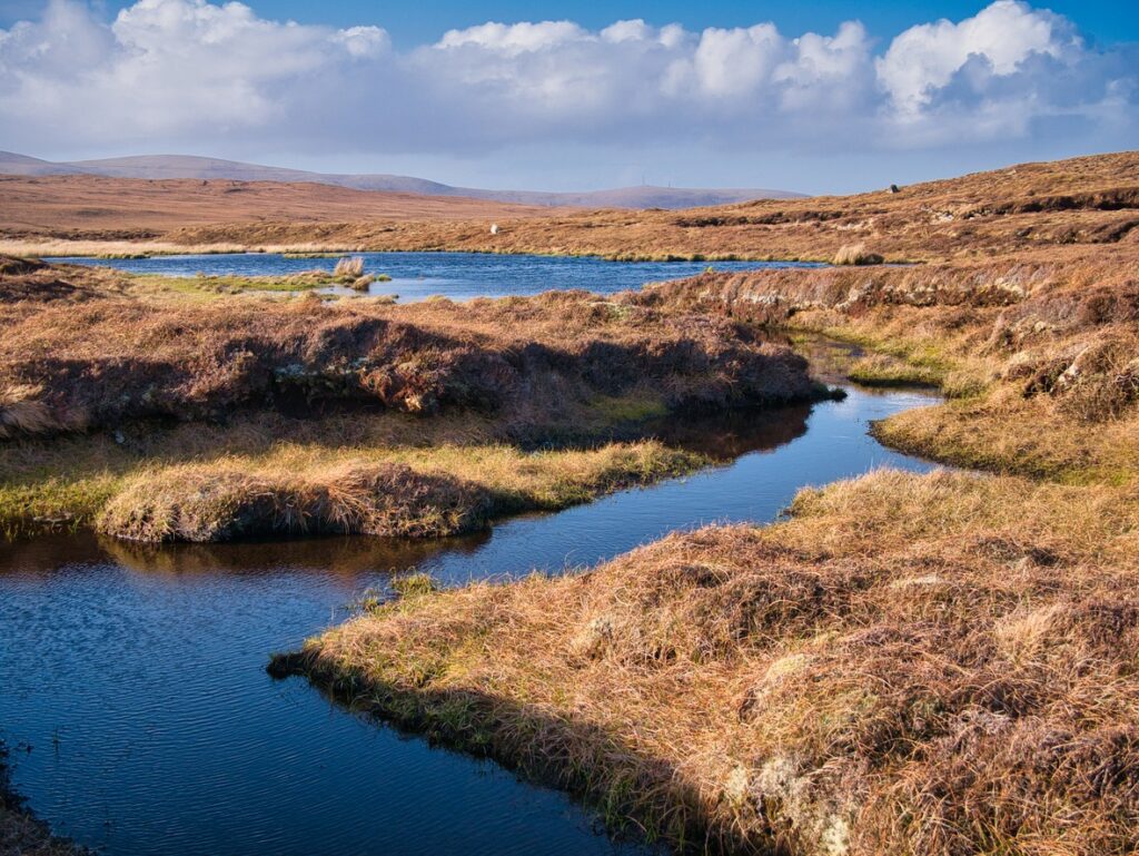
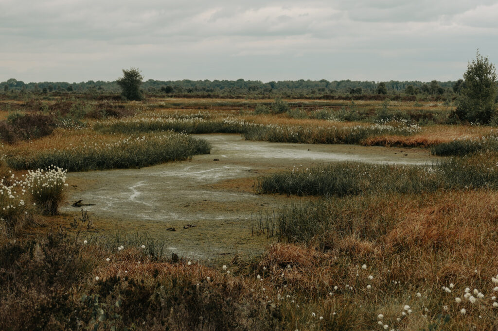
You’d be forgiven for not thinking much about peat. It doesn’t look especially exciting. But what sits beneath our feet in places like the Pennines, the North York Moors, Dartmoor, and the Norfolk Fens is one of nature’s most powerful tools for storing carbon, supporting wildlife and helping manage flood risk. The trouble is, over 80% of England’s peatlands are now considered degraded: dry, drained, damaged or dug up. And when peat dries out, it stops being a carbon store and starts being a carbon emitter.
That’s what makes this new map so important. It shows, for the first time in one place, just how widespread peatland damage is, while also helping experts identify which areas should be prioritised for repair. According to Natural England, restoring these peatlands could cut carbon emissions dramatically, improve water quality and bring rare habitats back from the brink. Tony Juniper, chair of Natural England, described the map as a “game-changing tool” that will allow conservation teams to target their efforts where they’ll do the most good.
Why peat is so important
@plymuni What are peatlands and why are they so important? Dr Scott Davidson, Lecturer in Ecosystem Resilience, explains why it is crucial we protect these beautiful areas. #universityofplymouth #environment #peatland #conservation #learnontiktok #environmentalscience #climatechange ♬ Ambient-style emotional piano – MoppySound
Peatlands only cover around 10% of the land in the UK, but they hold more carbon than all the forests in Britain combined. When they’re healthy, they absorb and lock in carbon for thousands of years. But when they’re drained, grazed or set alight, as has happened in many upland and lowland areas, they start to leak that carbon back into the atmosphere. That’s already happening across vast stretches of England, where degraded peatlands are now releasing an estimated 11 million tonnes of carbon dioxide each year.
This matters not just for climate targets, but for the health of rivers, wetlands, and drinking water supplies. Healthy peat acts like a sponge, slowly filtering water and releasing it gradually into rivers and reservoirs. When it’s damaged, the water runs off more quickly, increasing flood risks and water pollution. That’s why organisations like the RSPB and The Wildlife Trusts have long campaigned for better protection and restoration of peat.
What the new map reveals
The England Peat Map brings together over 300,000 soil samples, satellite data and drone footage to paint the clearest picture yet of the country’s peatlands. It not only shows where peat is located but also how deep it is, how intact it is, and what kind of vegetation is growing on top. That level of detail matters because restoring peat isn’t just about planting some moss and walking away; it’s about understanding the exact conditions on the ground and working with the landscape, not against it.
One of the more striking findings is that just 1% of peatland in England still has its original wet-loving vegetation like sphagnum moss. Most of the rest has been taken over by drier plants like heather and grasses that thrive in damaged areas. In practical terms, that tells us how far things have gone, but also where the few remaining patches of healthy peat still exist and need urgent protection.
You can see the interactive map here, which is open-access and freely available for farmers, landowners, conservation groups and researchers to explore.
Is this a tool for change, or just a pretty map?
Of course, not everyone is entirely convinced by the accuracy of the map. Some farmers and landowners have already pointed out errors, like peat showing up on rocky ground or under woodland, or missing altogether in known peat-rich areas. That’s not entirely surprising. Modelling landscapes on this scale involves compromise, and Natural England has made clear that this is a living tool, not the final word. It’ll be updated and improved over time with more ground-truthing and local feedback.
Still, for those working in conservation and land management, it’s a major leap forward. Being able to identify priority sites for restoration, especially in remote areas, is going to save time, money and guesswork. According to Juniper, restoring peatlands offers one of the most cost-effective ways to cut emissions and protect nature in England. The government’s own England Peat Action Plan sets out targets to re-wet 35,000 hectares of degraded peatland by 2025, and the map is expected to guide much of that work.
What restoration actually looks like
@sambbentley An erosional feature in a peatland, and what I would recommend to fix it! #ecology #restoration #conservation #peatland #work ♬ growth – Gede Yudis
Fixing peatland doesn’t mean turning it into a swamp or banning anyone from walking on it. But it does often involve blocking drainage channels, reintroducing wetland plants, and sometimes changing how the land is used, especially in places where peat has been farmed, grazed or dug for fuel.
In some cases, this will mean asking landowners to make big changes. That’s why funding schemes like the Sustainable Farming Incentive are being set up to help farmers manage peatland more sustainably, without losing income.
What’s clear is that time is running out. Peat forms at a glacial pace, at just a millimetre a year in some places, so once it’s gone, it’s not easily replaced. That’s why conservationists are calling for more urgency and more investment. This new map doesn’t solve everything, but it does give England a chance to act before more peat is lost forever.