Iceland isn’t just a cold little island with waterfalls and puffins—it’s one of the most geologically fascinating places on Earth.
With its fiery volcanoes, massive glaciers, bubbling geothermal fields and otherworldly terrain, Iceland looks like nature decided to run a bunch of different experiments all at once. Here’s how those powerful natural forces are shaping this wild and beautiful land in 13 unique ways.
1. Volcanoes created most of the island.
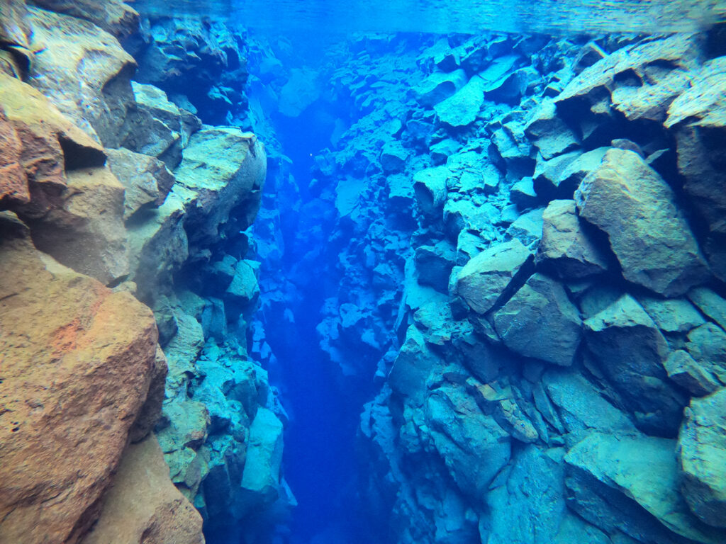
Almost the entire country is made from volcanic rock. Iceland sits on the Mid-Atlantic Ridge, where two tectonic plates are slowly pulling apart. As they separate, magma rises up and hardens into new land, essentially building the country from the bottom up. The constant volcanic activity is why the landscape feels so raw and dramatic. Black sand beaches, jagged lava fields and explosive craters aren’t just tourist photo ops—they’re signs of a country that’s still in the making.
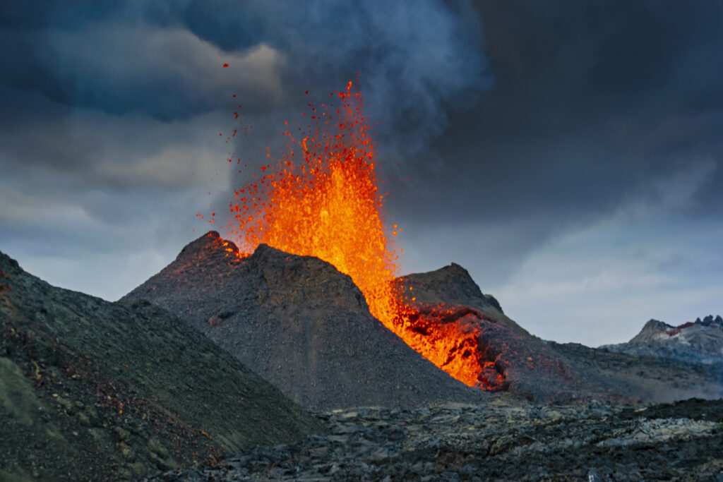
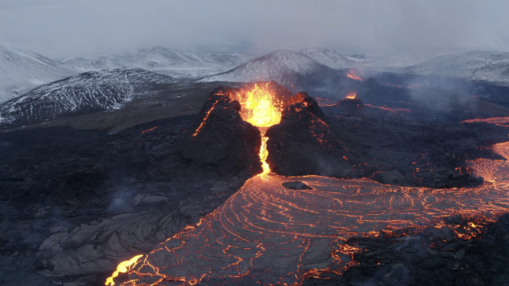
2. Eruptions have literally shaped towns.
In 1973, a surprise eruption on Heimaey island covered half a town in lava and forced thousands to evacuate overnight. Locals sprayed seawater on the lava to divert its flow and save the harbour. It worked—and the town still stands today.
Events like this aren’t ancient history. Iceland experiences eruptions frequently, including the recent ones near Grindavík. Living here means knowing that the ground can open up at any time—and that you might one day have to protect your driveway with a firehose.
3. Glaciers carve the land like slow-moving giants.
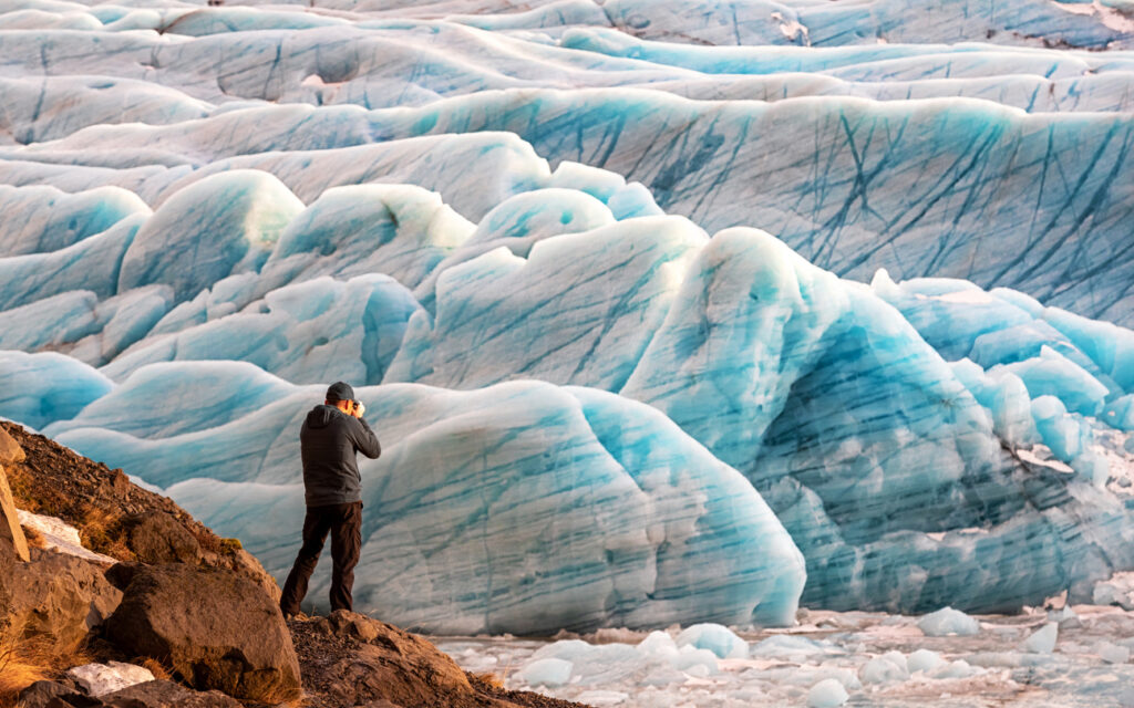
Iceland’s glaciers cover around 11% of the country and have been slowly grinding down the landscape for thousands of years. They carve out valleys, create dramatic fjords and leave behind huge deposits of rock and ice as they retreat. Glacier-fed rivers and waterfalls—like the famous Gullfoss—are a direct result of this glacial shaping. Without these frozen giants, Iceland would look a whole lot flatter and less cinematic.
4. Volcanoes and glaciers sometimes clash.
When a volcano erupts beneath a glacier, things get explosive fast. The heat melts tons of ice in minutes, triggering massive floods called jökulhlaups. These floods can destroy roads, bridges and anything in their way with terrifying force.
This is one of those only-in-Iceland natural disasters—fire and ice meeting head-on. Engineers now monitor glaciers closely to prepare for these sudden, brutal events, but they’re still a powerful reminder that Iceland’s landscape is never really at rest.
5. Geysers and hot springs bubble across the island.
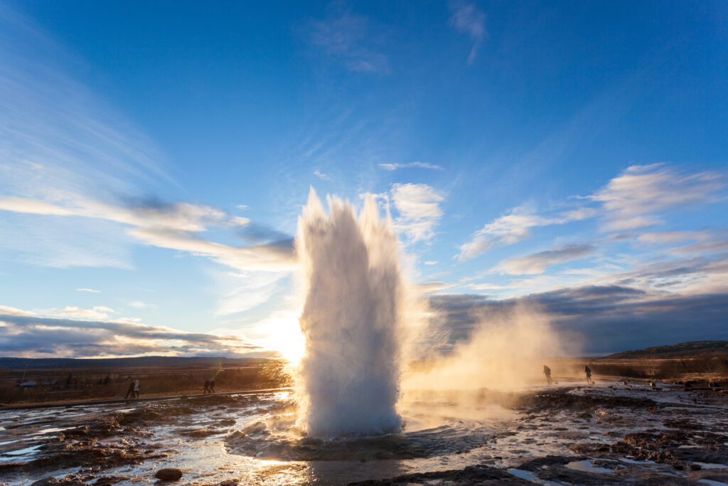
Thanks to all that underground heat, geothermal activity is everywhere. Iceland’s most famous geyser, Strokkur, erupts like clockwork every few minutes, shooting boiling water metres into the air. And it’s not the only one. From relaxing hot springs like the Blue Lagoon to steaming vents in empty fields, the country is full of places where the Earth literally breathes. It’s part of what makes Iceland feel alive in a way most landscapes don’t.
6. Geothermal power heats almost everything.
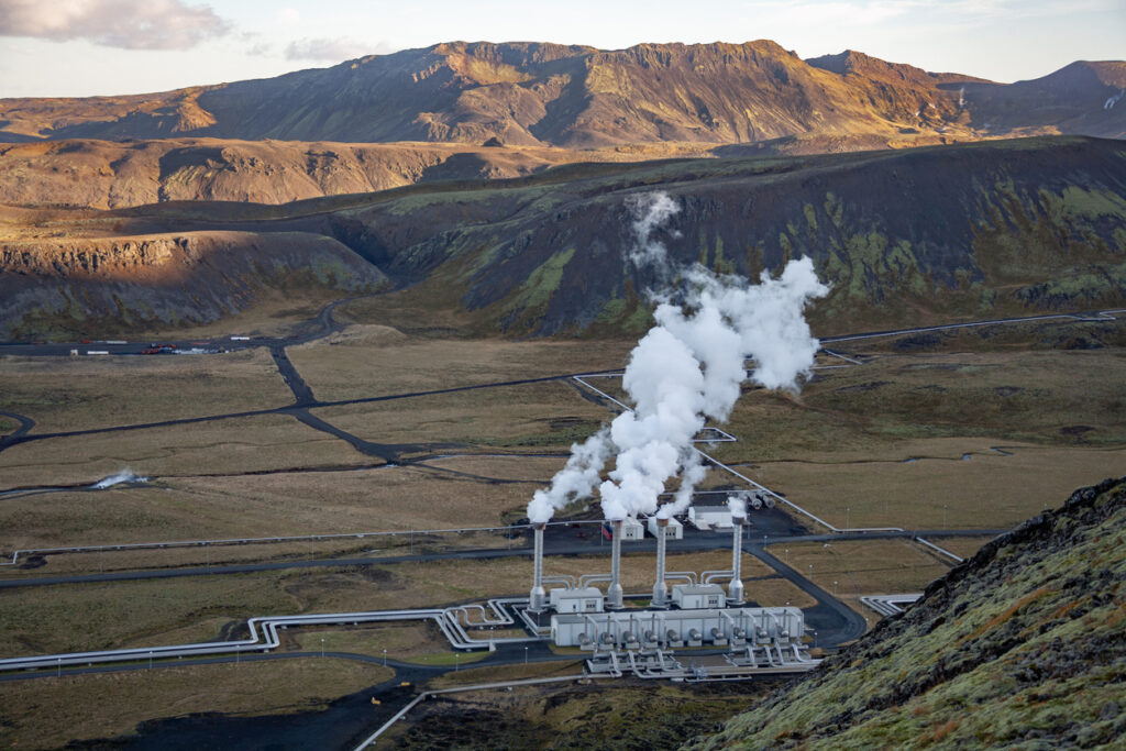
While other countries burn gas or coal to stay warm, Iceland pipes hot water directly from the ground into homes and businesses. Around 90% of buildings are heated this way, making it one of the cleanest energy systems in the world. It’s cheap, sustainable, and surprisingly reliable, even when snow is falling sideways outside. This natural resource has allowed Iceland to stay warm without wrecking the environment in the process.
7. Lava tubes and caves tell stories of past eruptions.
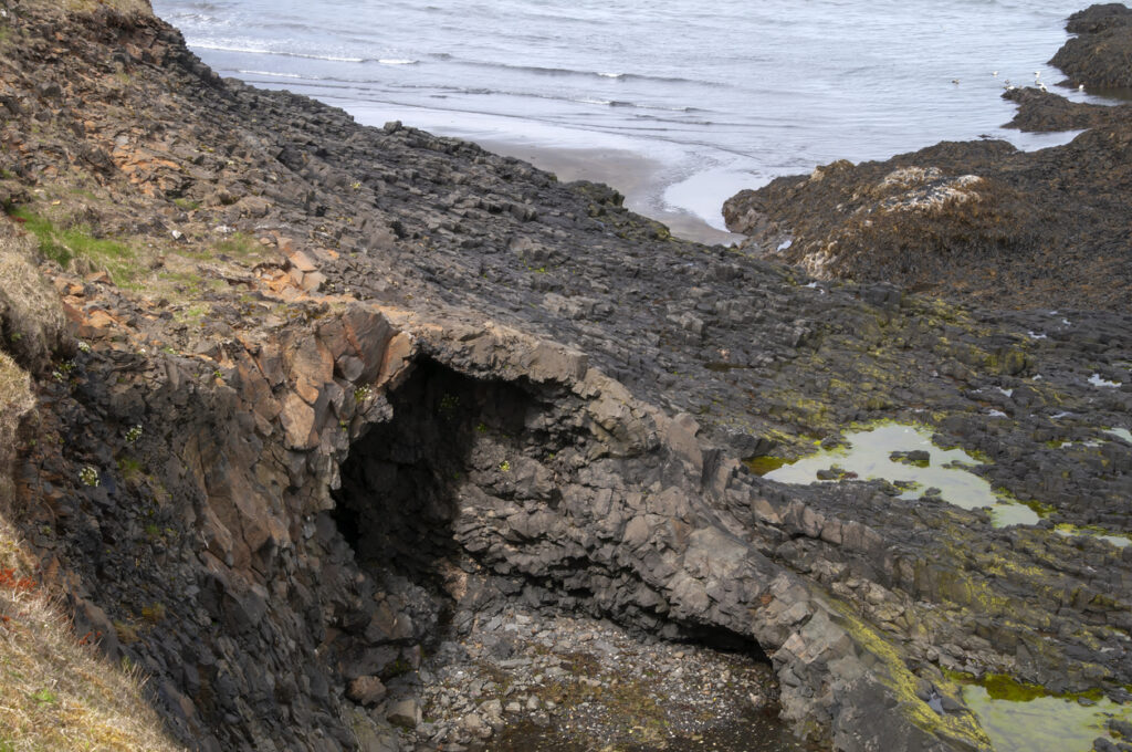
When lava flows cool on the outside but stay molten inside, they form tunnels called lava tubes. Some are massive—you can walk through them like underground hallways carved by fire. One of the most famous, Raufarhólshellir, is more than a kilometre long. These caves are frozen moments in volcanic time, showing off colourful rock layers, bizarre formations, and even icicles in winter. They’re a reminder that even after the eruption ends, the land keeps telling the story.
8. Earthquakes constantly change the landscape.
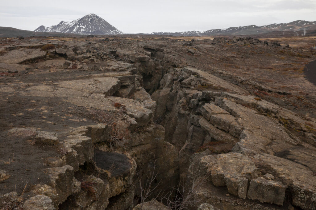
With tectonic plates literally tearing apart underfoot, earthquakes are part of daily life. Most are small and harmless, but some can shake things up properly. Iceland gets thousands of quakes a year, many of which go unnoticed by locals who are used to the ground having a mind of its own. These movements keep reshaping the terrain—cracking roads, raising lava fields and even altering where rivers flow. The Earth isn’t just alive here; it’s impatient and dramatic about it.
9. Ice caves form inside glaciers every winter.
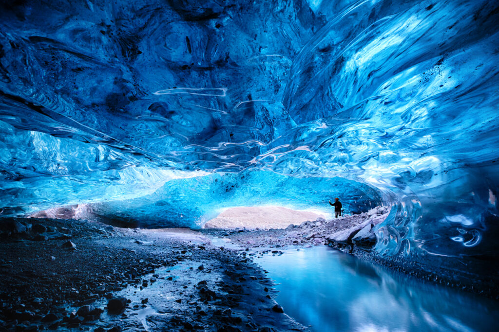
During colder months, meltwater tunnels freeze inside glaciers and form stunning blue caves that look like something out of a fantasy film. They only last a season before collapsing or shifting, which makes every visit a once-in-a-lifetime experience. Tourists can explore some of these with expert guides, but timing is everything. The caves change constantly and are shaped by both the warmth of geothermal heat and the pressure of tonnes of moving ice.
10. Black sand beaches line the coast.
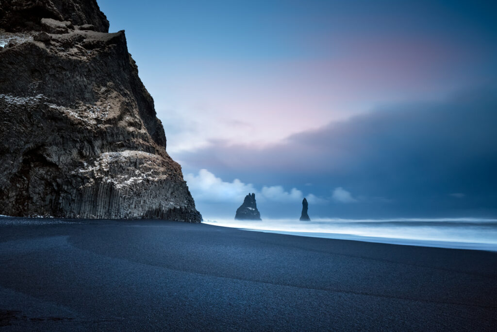
Unlike the white sands you find in tropical countries, Iceland’s beaches are jet black, made of crushed volcanic rock. Reynisfjara is the most famous—and one of the most dangerous, thanks to its powerful “sneaker waves.” The colour, texture, and eerie beauty of these beaches give them a moody, alien feel. You’re not just visiting a coastline—you’re walking on the remnants of ancient eruptions, now cooled and ground down by time and tide.
11. Craters and calderas dot the interior.
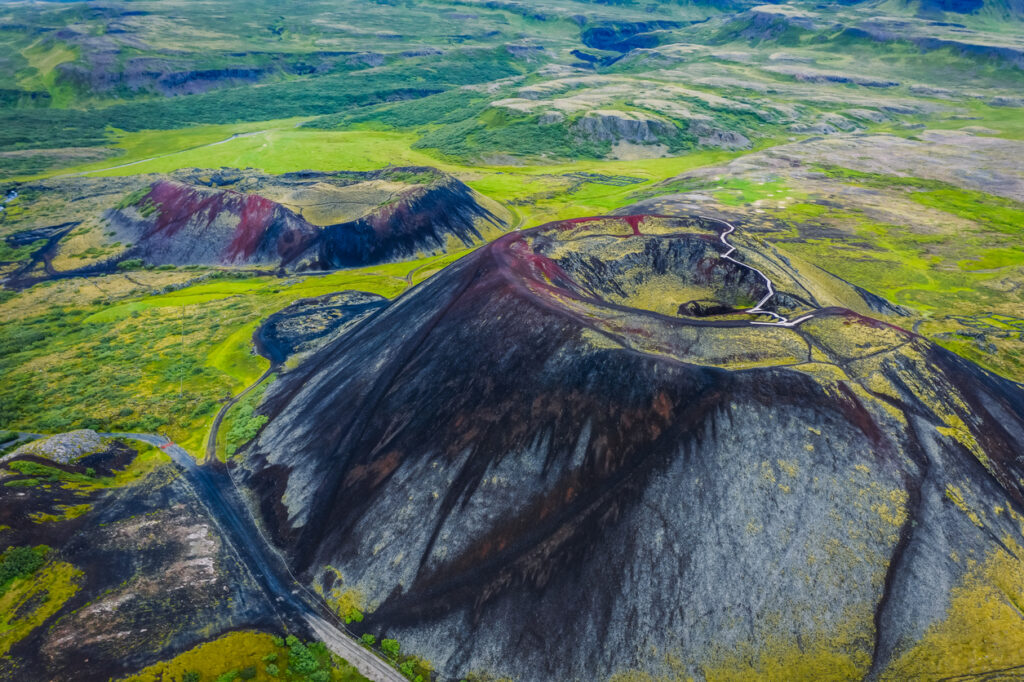
Iceland’s interior is filled with ancient craters, collapsed volcanoes, and steaming fissures. Some, like Askja, have filled with eerie blue lakes. Others look like lunar landscapes, especially in areas like the Highlands where vegetation barely grows. These aren’t just scars—they’re snapshots of explosive events that helped build the island. Hiking through them feels like stepping into another world, one shaped more by fire than by anything human.
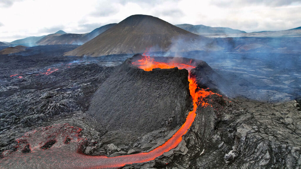
12. Fissure eruptions can stretch for kilometres.
Instead of a single volcanic cone, Iceland often experiences fissure eruptions—long cracks in the Earth that ooze lava for miles. The 2014–15 Holuhraun eruption, for example, created a new lava field nearly the size of Manhattan. These eruptions reshape the landscape on a huge scale, creating new land, destroying vegetation, and rewriting maps. They’re slow but relentless—and visually stunning if you’re lucky (or brave) enough to witness one.
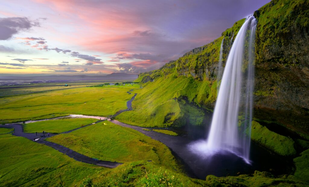
13. Waterfalls cascade from glacier-fed rivers.
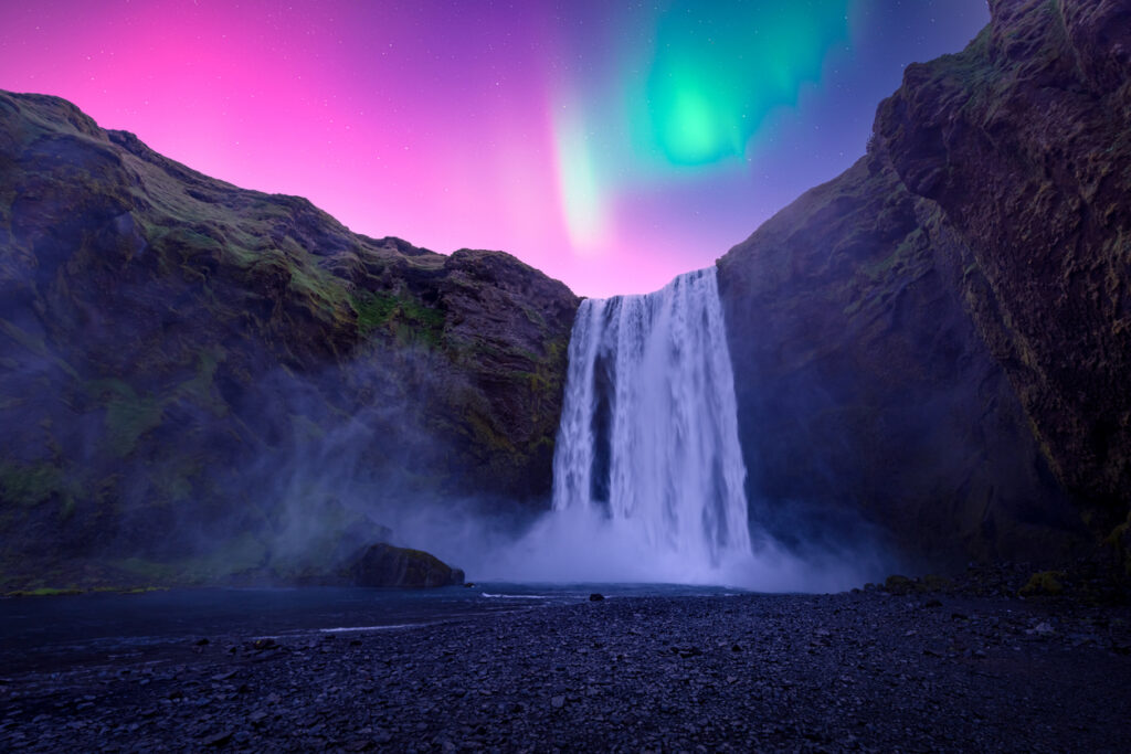
Iceland is packed with waterfalls, and many of them are the result of glaciers melting and spilling down the cliffs. Skógafoss, Seljalandsfoss, and Dettifoss all get their volume from ice turning into rushing water and slicing through the landscape.
These waterfalls aren’t just pretty—they’re also powerful. Some have carved deep canyons, while others shift course slightly every year. They’re constant proof that water, just like fire, plays a huge role in shaping this land of extremes.