Most of the hills and valleys we’re used to were shaped by millions of years of gradual change, but there are certain spots where the earth basically had a total meltdown.

We’re talking about massive scars in the landscape that only exist because of a sudden, violent event like a catastrophic flood, a volcanic collapse, or a meteor slamming into the ground at 1000s of miles per hour. These aren’t just pretty views; they’re physical evidence of a day when everything went south in a major way.
It’s a bit of a reality check to realise that some of our most famous landmarks are actually the result of a prehistoric disaster. Understanding how these 10 features formed changes how you look at the planet, proving that the natural world can move very fast when things go spectacularly wrong.
Sinkholes formed when the ground literally gave up.

Sinkholes are not gentle features shaped over millennia. They form when underground rock dissolves or collapses, leaving nothing to support the surface above. Limestone is especially vulnerable, slowly eaten away by water until the ground can no longer hold itself together. When a sinkhole appears, it’s often sudden and violent. Roads vanish, buildings drop, and landscapes rearrange themselves in minutes. These features exist because a hidden support system failed, turning solid ground into a trapdoor with no warning.
2. Volcanic calderas left behind after eruptions went too far.

Calderas aren’t just volcano craters. They form when an eruption is so massive that the magma chamber beneath empties faster than the ground above can cope. The surface collapses inward, creating enormous basins. These features exist because the volcano effectively destroyed itself. The eruption didn’t just release pressure, it removed the structure holding the mountain up. What looks peaceful today was once the site of catastrophic failure on a planetary scale.
3. Deserts created by climate systems breaking down.
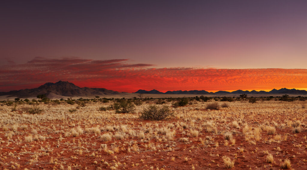
Not all deserts are ancient or inevitable. Some formed when climate patterns shifted abruptly, cutting off rainfall that ecosystems depended on. Grasslands and forests dried out, soil degraded, and recovery became impossible. These landscapes exist because natural feedback systems failed. Once vegetation was lost, the land heated faster, held less moisture, and locked itself into permanent dryness. The desert wasn’t planned. It was the result of collapse.
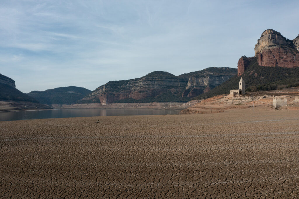
4. Salt flats left behind when entire seas disappeared.

Salt flats are the ghosts of ancient lakes and seas that no longer exist. They form when bodies of water dry up completely, leaving dissolved minerals behind. This happens when inflows stop or evaporation overwhelms replenishment. The system fails to sustain itself, and the water vanishes. What remains is a stark reminder that even vast inland seas can simply cease to exist under the wrong conditions.
5. Canyons carved by water escaping confinement.

Some canyons weren’t shaped by calm, steady rivers over endless time. They were carved by sudden releases of water after natural dams collapsed, or ice sheets melted rapidly. These floods tore through rock with overwhelming force, reshaping entire regions. The canyon exists because water went where it was never meant to go, at volumes the landscape couldn’t withstand.
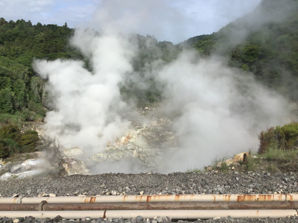
6. Crater lakes formed by impacts and explosions.
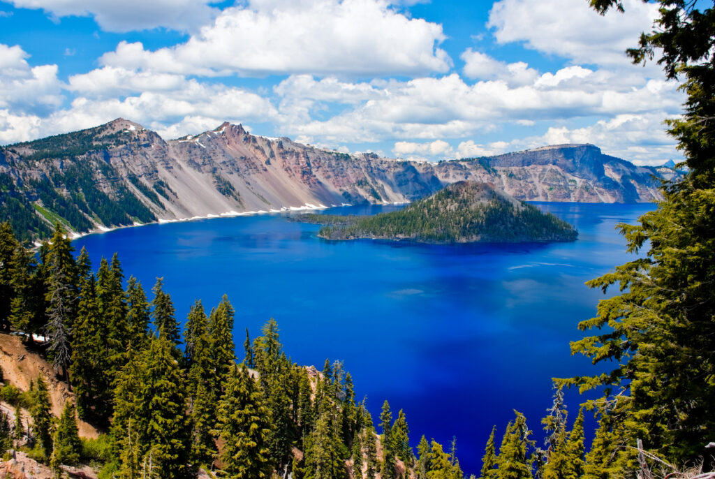
Some lakes sit in bowls that were never intended to exist. Meteorite impacts, volcanic explosions, or violent collapses created depressions that later filled with water. These serene bodies of water hide violent origins. The land was punched, blasted, or ripped open, then quietly flooded. The calm surface disguises a history of sudden destruction.
7. Landslide scars where mountains failed structurally.
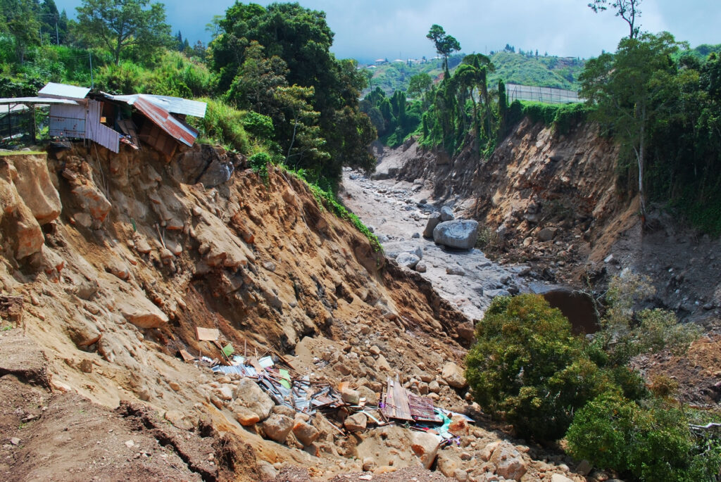
Mountains are often seen as symbols of stability, but many landscapes show clear evidence of massive slope failures. Landslides occur when rock, soil, and vegetation lose cohesion and give way. These features exist because gravity won. Water infiltration, earthquakes, or erosion weakened the structure until collapse became inevitable. What remains is a scar that permanently alters the mountain’s shape.
8. Rift valleys created when continents started tearing apart.
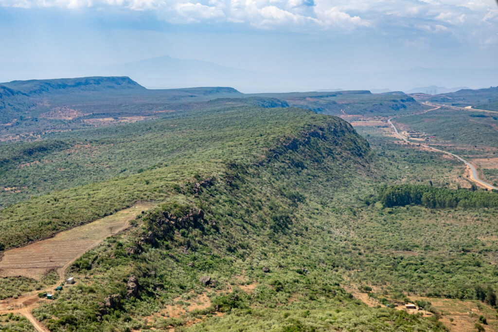
Rift valleys form when tectonic plates stretch and thin until the crust fractures. Instead of colliding, the land pulls itself apart. The result is a deep valley formed not by building, but by failure to stay intact. These landscapes exist because the planet’s surface couldn’t hold together under internal stress.
9. Dead zones where water systems collapsed.
Some coastal and lake regions lack oxygen entirely, unable to support most life. These dead zones form when nutrient overloads trigger massive algae blooms that consume oxygen as they decay. The feature exists because a delicate balance broke down. Once oxygen disappears, ecosystems collapse, leaving behind lifeless stretches of water that persist long after the initial trigger.
10. Permafrost craters formed when frozen ground destabilised.
In polar regions, massive craters have appeared when permafrost trapped gases beneath the surface. As temperatures rose, pressure built until the ground burst open. These features exist because frozen systems that held the land together failed. What was once stable ground became volatile, producing explosions where nothing dramatic was supposed to happen.