Most of the time, looking at the sky is a fairly predictable business of grey sheets or white fluffy bits, especially in the UK.
However, every now and then, the atmosphere puts on a show that looks like something out of a sci-fi film. There are certain types of clouds that only pop up when the temperature, wind speed, and moisture levels hit a very specific Goldilocks zone. They’re so rare that even seasoned meteorologists get a bit buzzy when they spot one, and if you’re lucky enough to see them, you’re basically witnessing a glitch in the sky’s matrix. These aren’t your average rain clouds; they’re the result of perfectly balanced chaos in the upper layers of the air.
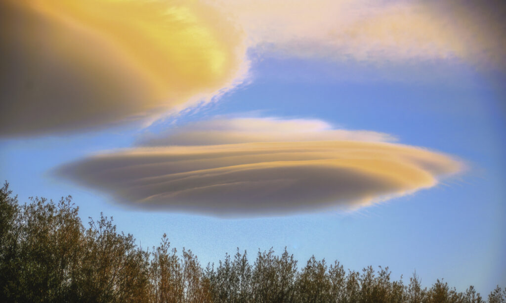
1. Lenticular clouds
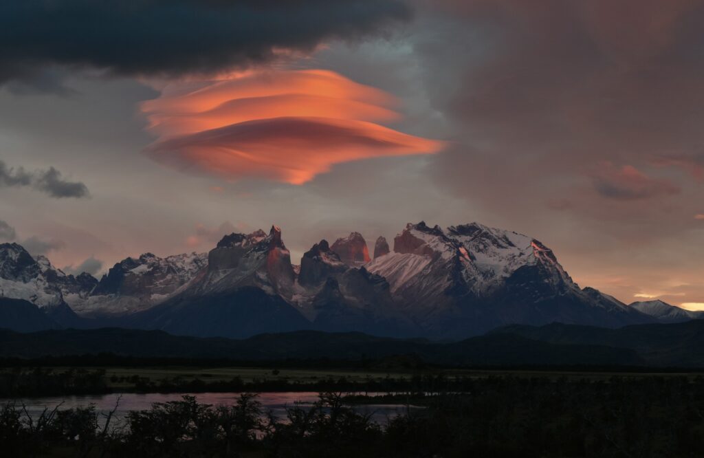
Lenticular clouds look like stacked flying saucers hovering over hills or mountains. They form when moist air flows over a ridge and creates standing waves in the atmosphere, with condensation happening at the crest of each wave. If the wind speed and direction aren’t right, they simply won’t appear, which is why they’re most common in specific locations. When they do show up, they look so solid and symmetrical that people often mistake them for something mechanical rather than natural.
2. Noctilucent clouds
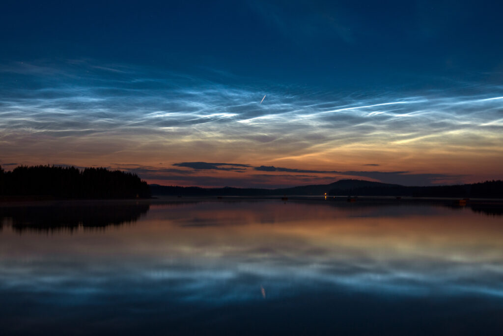
These are the highest clouds in Earth’s atmosphere, forming around 80 kilometres up in the mesosphere. They’re only visible during deep twilight in summer, when the Sun is below the horizon for you but still illuminating the very high-altitude ice crystals. The result is an electric blue, glowing pattern that looks almost artificial against a dark sky. If the air isn’t cold enough at that altitude, or the light angle isn’t exact, they simply don’t form.
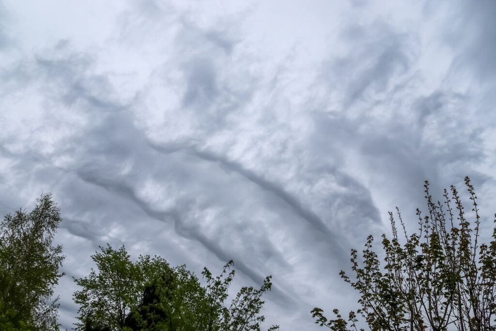
3. Kelvin-Helmholtz clouds
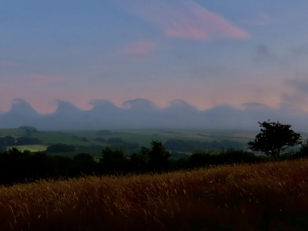
If you’ve ever seen a cloud that looks like a row of ocean waves about to crash, that’s likely a Kelvin-Helmholtz formation. They appear when two layers of air move at different speeds, creating a rolling effect at the boundary between them. The balance has to be just right because if the wind shear is too strong or too weak, the pattern breaks apart. When they do form, they look like the sky has frozen mid-surf.
4. Mammatus clouds
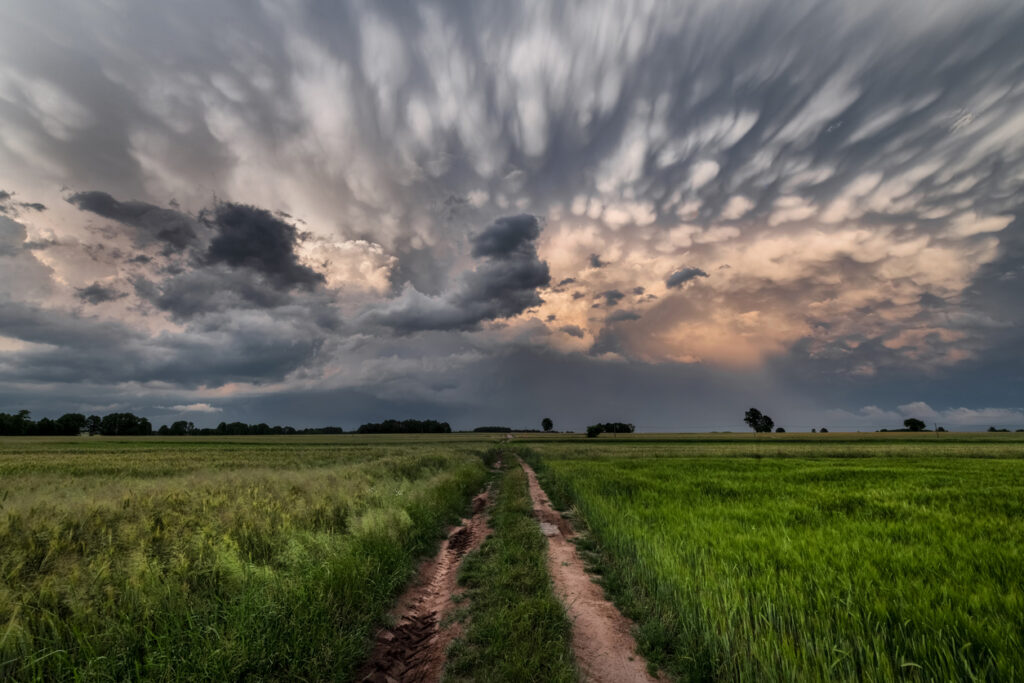
Mammatus clouds hang like pouches or bubbles from the underside of larger storm clouds. They often appear after severe weather, especially when sinking air is interacting with strong updrafts above. The sight can look dramatic and slightly ominous, even though mammatus themselves aren’t always dangerous. Their rounded, hanging shapes only develop when temperature and moisture differences line up in a very specific way.
5. Asperitas clouds
Asperitas clouds create a sky that looks like a stormy sea viewed from below, with rolling, chaotic textures stretching across the horizon. They’re relatively newly classified and are still being studied, which adds to their mystique. They tend to form after thunderstorms when the atmosphere is unsettled but not actively storming. Without the right balance of instability and light, the effect simply doesn’t show.
6. Pileus clouds
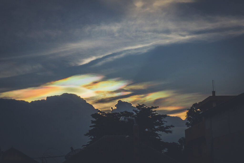
Pileus clouds sit like a delicate cap on top of towering cumulus or cumulonimbus clouds. They form when strong updrafts push moist air upward quickly, causing a smooth, thin cloud layer to appear above the main cloud. If the rising air weakens even slightly, the cap vanishes. Sometimes they even show subtle rainbow colours when sunlight hits the tiny water droplets at just the right angle.
7. Fallstreak holes
Also known as hole-punch clouds, these look like someone has taken a giant cookie cutter to the sky. They form in thin layers of cloud when supercooled water droplets suddenly freeze and fall as ice crystals, leaving a circular gap behind. Aircraft can sometimes trigger them by disturbing the air. The combination of temperature and droplet size has to be precise; otherwise the cloud layer stays intact.
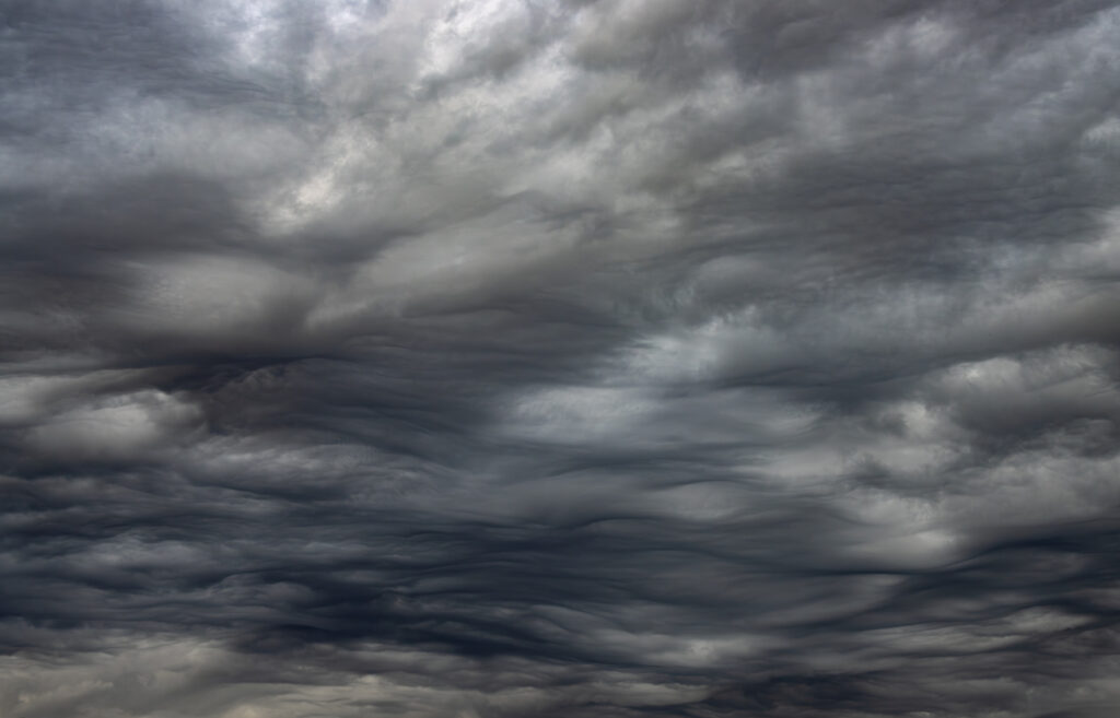
8. Undulatus asperatus
Closely related to asperitas, undulatus asperatus creates heavy, rolling wave patterns that can look almost apocalyptic. The key ingredient is turbulent air in the lower atmosphere combined with moisture at mid-levels. If the turbulence settles too quickly, the waves smooth out and the effect disappears. When it does appear, it feels like the sky has turned into a shifting landscape of shadow and light.
9. Polar stratospheric clouds
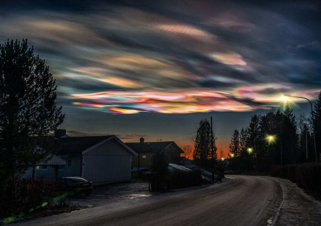
These form in extremely cold conditions high in the stratosphere near the poles. Temperatures have to drop far below freezing before they appear, which is why they’re so rare. When sunlight hits them at low angles, they can glow in bright pastel colours, almost like oil on water. They’re beautiful, but also linked to chemical reactions that affect the ozone layer.
10. Morning glory clouds
Morning glory clouds are long, rolling tube clouds that can stretch for hundreds of kilometres. They’re most famously seen in northern Australia, where the geography and sea breezes create just the right pressure waves at dawn. If the timing is off by even a small margin, they won’t form. When they do, they look like a giant horizontal roller sweeping across the sky in complete silence.
Clouds might seem ordinary, but the rare ones remind you how delicate the balance of the atmosphere really is. Temperature, wind, moisture, and light all have to align perfectly. When they do, the sky briefly turns into something that feels almost unreal.